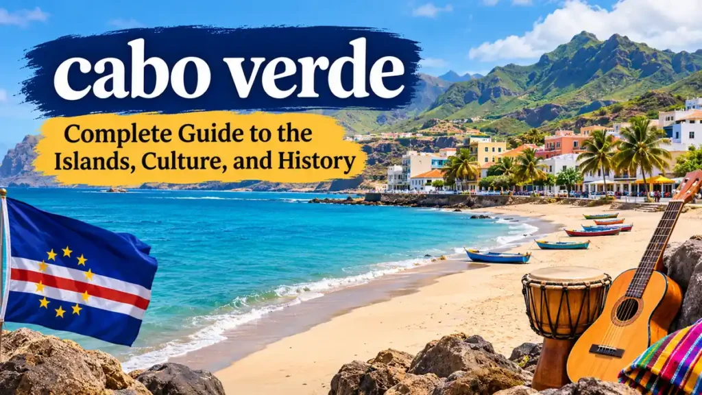
Ten volcanic islands scattered across the Atlantic Ocean form one of Africa’s most distinctive island nations. With dramatic mountains, golden beaches, lively music, and a blend of African and Portuguese influences, cabo verde offers far more than a tropical coastline.
cabo verde, officially the Republic of Cabo Verde, is an island country off the western coast of Africa. Its archipelago consists of ten main islands, nine of which are inhabited. The capital is Praia, on Santiago Island. Portuguese is the official language, while Cape Verdean Creole is widely spoken in everyday life.
The country is also commonly known as Cape Verde. Its geography, history, and culture make it an important Atlantic crossroads between Africa, Europe, and the Americas.
Where Is cabo verde Located?
cabo verde lies in the central Atlantic Ocean, approximately 500–600 kilometers west of Senegal, depending on the island and reference point.
The country belongs geographically to Africa, although its location in the ocean gives it a distinctive maritime identity.
Geography and Location
The archipelago is part of Macaronesia, a biogeographical region that also includes the Azores, Madeira, and the Canary Islands.
Its position has historically connected maritime routes between continents.
| Geographic feature | Description |
|---|---|
| Continent | Africa |
| Ocean | Atlantic Ocean |
| Capital | Praia |
| Main islands | 10 |
| Inhabited main islands | 9 |
| Total land area | Approximately 4,033 km² |
| Nearest mainland region | West Africa |
| Time zone | UTC−1 (CVT) |
Unlike many tropical island groups, cabo verde has a predominantly dry climate. Some islands have desert-like landscapes, while others feature fertile valleys and mountainous terrain.
Is cabo verde Part of Portugal?
No. cabo verde is an independent African nation.
It was formerly a Portuguese colony and gained independence on July 5, 1975. Portuguese influence remains visible in its architecture, language, surnames, and cultural traditions.
The 10 Islands of cabo verde Explained
The archipelago contains ten main islands and several smaller islets. Each island has its own landscape, cultural character, and natural attractions.
The islands are traditionally divided into two groups: Barlavento, the windward islands, and Sotavento, the leeward islands.
Barlavento Islands
The northern group contains six main islands:
- Santo Antão — known for mountains, agricultural terraces, and hiking trails.
- São Vicente — home to Mindelo, a major cultural center.
- Santa Luzia — uninhabited and environmentally protected.
- São Nicolau — characterized by mountain scenery and traditional communities.
- Sal — famous for sandy beaches, salt flats, and water sports.
- Boa Vista — recognized for extensive dunes, beaches, and sea turtle nesting sites.
Sotavento Islands
The southern group contains four main islands:
- Maio — a quieter island with long beaches and small settlements.
- Santiago — the largest and most populous island, containing the capital, Praia.
- Fogo — dominated by an active volcano and remarkable volcanic landscapes.
- Brava — a small, mountainous island known for its greenery and flowers.
Comparing the Islands
| Island | Main characteristic | Notable place |
|---|---|---|
| Sal | Beaches and water sports | Santa Maria |
| Boa Vista | Sand dunes and marine wildlife | Sal Rei |
| Santiago | History and urban culture | Praia, Cidade Velha |
| São Vicente | Music and festivals | Mindelo |
| Santo Antão | Mountain trekking | Paul Valley |
| Fogo | Volcanic landscapes | Pico do Fogo |
| São Nicolau | Traditional villages | Ribeira Brava |
| Maio | Quiet coastline | Vila do Maio |
| Brava | Green mountain scenery | Nova Sintra |
| Santa Luzia | Protected natural environment | Uninhabited island |
Santiago provides a strong introduction to the country’s history, while Santo Antão and Fogo reveal the dramatic geological forces that shaped the archipelago.
The History of cabo verde
The history of cabo verde reflects centuries of Atlantic exploration, colonial trade, migration, and cultural exchange.
Portuguese Settlement and the Atlantic Trade
Portuguese navigators reached the islands in the 15th century. Permanent settlement began around 1462 on Santiago, where Ribeira Grande developed into an important colonial settlement.
The islands became a strategic location for Atlantic shipping and the transatlantic slave trade.
Enslaved Africans were brought to the islands, and the interactions between African communities and Portuguese settlers contributed to the development of Cape Verdean Creole language and culture.
The settlement of Ribeira Grande, now called Cidade Velha, is recognized as a UNESCO World Heritage Site for its historical importance.
Independence in 1975
The struggle for independence was closely associated with the African Party for the Independence of Guinea and Cape Verde (PAIGC) and the political leadership of Amílcar Cabral.
Cabral was assassinated in 1973, before independence was achieved.
On July 5, 1975, cabo verde became independent from Portugal.
Aristides Pereira served as the country’s first president. Following a period of single-party rule, the nation transitioned to multiparty democracy in 1991.
Modern Political Development
Today, cabo verde operates as a multiparty republic with an elected president and parliamentary government.
Its democratic institutions and history of peaceful political transitions have contributed to its reputation for political stability.
However, the country continues to face challenges involving water scarcity, imported energy, limited natural resources, and dependence on external economic conditions.
Culture, Language, and Traditions of cabo verde
One of the most distinctive aspects of cabo verde is its cultural identity, shaped by African heritage, Portuguese colonial history, and centuries of migration.
The country’s traditions are expressed through music, storytelling, food, religious celebrations, and strong family connections.
What Language Is Spoken in cabo verde?
Portuguese is the official language used in government, formal education, and official documents.
However, Cape Verdean Creole, commonly called Kriolu, is the language of everyday conversation for much of the population.
Kriolu has several island-specific varieties, reflecting the country’s history and regional differences.
Some useful expressions include:
| Expression | Meaning |
|---|---|
| Bom dia | Good morning |
| Obrigado / Obrigada | Thank you in Portuguese |
| Morabeza | Warmth, hospitality, and friendliness |
| Sodade | Longing or nostalgia |
| Nha | My, in many Creole expressions |
English, French, and other European languages may also be spoken in tourism-related settings.
Traditional Music and Dance
Music is central to Cape Verdean identity.
The most internationally recognized musical style is morna, a melodic tradition associated with themes of longing, love, migration, and separation.
UNESCO added morna to its Representative List of the Intangible Cultural Heritage of Humanity in 2019.
Other important musical traditions include:
- Coladeira: Rhythmic music frequently associated with dancing and social gatherings.
- Funáná: An energetic style strongly connected to Santiago, traditionally featuring the accordion and a metal scraper.
- Batuque: A percussion-based musical and dance tradition with deep African roots.
- Tabanka: A cultural expression involving music, processions, and community celebrations.
The internationally celebrated singer Cesária Évora helped introduce morna to global audiences. Known as the Barefoot Diva, she became one of the country’s most influential cultural figures.
The Meaning of Morabeza
Morabeza describes a sense of warmth, generosity, friendliness, and welcoming hospitality associated with Cape Verdean society.
It is more than a tourism slogan. The expression reflects a cultural ideal of treating others with kindness and maintaining close social relationships.
Visitors may encounter this spirit in neighborhood gatherings, local markets, music performances, and family-run establishments.
What Is the Climate Like in cabo verde?
cabo verde has a generally warm, dry tropical climate influenced by Atlantic trade winds.
Temperatures remain relatively moderate throughout the year compared with many mainland tropical destinations.
Weather Throughout the Year
| Season | Typical conditions | Main characteristics |
|---|---|---|
| December–February | Mild, dry, breezy | Comfortable temperatures and strong winds |
| March–May | Warm and generally dry | Low rainfall and sunny conditions |
| June–August | Warmer, increasingly humid | Beginning of the wetter period |
| September–October | Warmest and potentially wettest | Greater chance of heavy showers |
| November | Transition toward dry weather | Decreasing rainfall |
Coastal temperatures commonly range from approximately 22°C to 30°C across the year, although conditions vary by island, altitude, and season.
When Is the Best Time to Visit cabo verde?
For many travelers, November through June provides relatively dry conditions.
However, the most suitable period depends on the activity:
- Beach holidays: Many months offer warm weather, with local wind conditions affecting comfort.
- Hiking: Cooler, drier months can be more comfortable.
- Windsurfing and kitesurfing: The windier winter and spring months are especially popular.
- Wildlife observation: Timing depends on the species and island.
- Cultural festivals: Events occur at different times throughout the year.
The islands do not share identical weather patterns. Santo Antão’s mountains can receive more moisture than the dry landscapes of Sal and Boa Vista.
Does cabo verde Experience Hurricanes?
The waters around the archipelago can occasionally produce tropical disturbances that develop into Atlantic storms.
Some Atlantic hurricanes have originated from tropical waves moving westward from the African coast near the islands.
Direct hurricane impacts are relatively uncommon, but heavy rainfall, strong winds, and rough seas can occur during the wetter season.
Travelers should monitor official forecasts, especially from August through October.
Natural Attractions and Wildlife in cabo verde
The archipelago’s volcanic origins have created landscapes ranging from steep mountain ridges to sandy deserts and black volcanic plains.
Its isolation has also supported distinctive ecosystems and species.
Pico do Fogo: The Active Volcano
Pico do Fogo, on Fogo Island, is the highest point in cabo verde, reaching approximately 2,829 meters above sea level.
The volcano dominates the island and is surrounded by the dramatic landscape of Chã das Caldeiras.
Its most recent eruption occurred in 2014–2015, causing substantial damage to nearby settlements and infrastructure.
The volcanic soils support some agricultural activity, including grape cultivation, despite the challenging environment.
Santo Antão’s Mountain Valleys
Santo Antão offers some of the archipelago’s most dramatic scenery.
Its landscape includes deep valleys, steep cliffs, terraced fields, and winding mountain paths.
Paul Valley and Ribeira Grande are particularly associated with agricultural communities and hiking routes.
The island’s terrain contrasts sharply with the flatter, sandier environments of Sal and Boa Vista.
Sea Turtles and Marine Biodiversity
cabo verde is an important nesting area for loggerhead sea turtles (Caretta caretta), particularly on Boa Vista and Sal.
Nesting generally occurs during the warmer months, with exact timing varying by location and year.
Conservation organizations work to protect nesting beaches from threats such as artificial lighting, habitat disturbance, illegal harvesting, and coastal development.
The surrounding waters also support dolphins, whales, sharks, rays, and diverse fish species.
Marine conservation is especially important because tourism and coastal development can place pressure on sensitive habitats.
Endemic Species
Geographic isolation has contributed to the evolution of species found naturally only in the islands or nearby region.
Examples include the Raso lark, a critically endangered bird associated with the archipelago, and several endemic reptiles.
Protected areas such as the Santa Luzia Nature Reserve play an important role in conserving vulnerable ecosystems.
Economy, Population, and Everyday Life
cabo verde has a small, service-oriented economy closely connected to international tourism, trade, migration, and remittances.
Its limited land area and dry climate make large-scale agriculture difficult.
Population and Major Cities
According to the World Bank, the country’s population was approximately 527,326 in 2025.
Praia, on Santiago, is the capital and largest urban center.
Other important towns and cities include Mindelo, Santa Maria, Assomada, Espargos, and Sal Rei.
The Cape Verdean diaspora is also significant, with communities established in Portugal, the United States, the Netherlands, France, and other countries.
Migration has shaped the country’s family networks, cultural traditions, and economic development.
Main Economic Activities
Tourism is one of the leading economic sectors, particularly on Sal and Boa Vista.
Other activities include fisheries, transport, commerce, construction, public services, and small-scale agriculture.
The World Bank reported real GDP growth of 6.3% in 2025, supported by tourism and domestic demand. It also identified weak inter-island transport connections and dependence on tourism as important economic vulnerabilities.
Currency and Cost of Living
The national currency is the Cape Verdean escudo (CVE).
It is pegged to the euro at a fixed official rate of approximately 110.265 CVE per euro.
Prices can vary considerably between islands, particularly because many goods must be imported.
Imported food, fuel, and manufactured products may be relatively expensive, while some locally produced goods and services can be more affordable.
Agriculture and Food Security
Rainfall is limited and irregular, creating challenges for agricultural production.
Farmers grow crops such as maize, beans, sugarcane, and vegetables where soil and water conditions allow.
Fishing also contributes to local food supplies and livelihoods.
Desalination is an important source of freshwater, particularly on islands with limited natural water resources.
Traditional Food in cabo verde
Cape Verdean cuisine reflects African and Portuguese culinary influences, with strong emphasis on grains, legumes, seafood, and slow-cooked dishes.
Cachupa: The National Dish
Cachupa is widely regarded as the national dish.
It is a slow-cooked stew usually prepared with maize, beans, vegetables, and sometimes meat or fish.
There are several variations, including cachupa rica, which typically contains more meat or other ingredients, and simpler versions based on available produce.
Leftover cachupa may be fried and served for breakfast, often with eggs.
Other Popular Foods
| Dish | Description |
|---|---|
| Cachupa | Maize-and-bean stew |
| Pastel com diabo dentro | Fried pastry commonly filled with spicy fish |
| Caldo de peixe | Traditional fish soup or stew |
| Buzio | Sea-snail dish prepared in various ways |
| Grogue | Sugarcane spirit traditionally produced on the islands |
| Doce de papaya | Sweet papaya preserve |
Fresh fish is an important part of coastal cuisine, and dishes may feature tuna, grouper, or other locally available species.
Food traditions vary between islands and households, so no single recipe represents the entire country.
How to Travel Around cabo verde
Travel between the islands requires planning because distances, weather conditions, and transport availability can affect connections.
International Airports
The archipelago has several international airports, including:
- Amílcar Cabral International Airport on Sal.
- Nelson Mandela International Airport on Santiago.
- Aristides Pereira International Airport on Boa Vista.
- Cesária Évora International Airport on São Vicente.
International flight connections vary by season and airline.
Traveling Between Islands
Domestic flights and ferries provide transport between the islands.
Ferries can be particularly useful for certain neighboring island pairs, including São Vicente and Santo Antão.
However, maritime conditions and operational schedules can cause delays or cancellations.
The World Bank has identified inter-island connectivity as a significant obstacle to economic development and access to opportunities.
Travelers should allow extra time when arranging connections between separate islands.
Entry Requirements
Entry requirements depend on nationality, passport type, and intended length of stay.
Some nationalities are visa-exempt, while others must obtain a visa before traveling. The government’s EASE system is used for traveler pre-registration, and an airport security fee may apply.
The official government portal provides current requirements: Cabo Verde visa information.
Important Places to Explore in cabo verde
The country’s cultural and natural attractions are spread across multiple islands, so understanding their locations helps explain its diversity.
Cidade Velha: A UNESCO World Heritage Site
Located on Santiago, Cidade Velha preserves important evidence of the early colonial Atlantic world.
Its historical landmarks include the Fortaleza Real de São Filipe, the Pelourinho, and surviving religious structures.
UNESCO recognizes the historic center for its role in early European colonial expansion and Atlantic maritime trade.
Mindelo: The Cultural Capital
Mindelo, on São Vicente, is famous for its musical heritage, colorful architecture, and carnival celebrations.
Its harbor has long connected the city with international shipping and migration routes.
The city is closely associated with Cesária Évora and the development of Cape Verdean popular music.
Santa Maria and Sal
Santa Maria is a major coastal settlement on Sal, known for its long sandy beach and watersports.
Sal’s flat landscape, salt pans, and consistent winds distinguish it from the mountainous islands.
The Pedra de Lume salt crater is another notable geographical attraction.
Boa Vista’s Beaches and Dunes
Boa Vista is known for extensive beaches, dry landscapes, and sand dunes.
Its coastline is particularly important for loggerhead turtle nesting.
Beach conditions can change with currents and seasonal winds, so not every stretch of coastline is suitable for swimming.
What Makes cabo verde Different From Other Island Nations?
Several characteristics distinguish cabo verde from other Atlantic and African island destinations.
First, its landscapes vary dramatically across a relatively small archipelago. A traveler can encounter volcanic mountains, agricultural valleys, desert dunes, and extensive sandy beaches.
Second, the country’s cultural identity reflects centuries of African-European interaction rather than belonging exclusively to one historical tradition.
Third, music and migration play unusually prominent roles in national identity. The emotional concept of sodade, or longing, reflects the experiences of families separated by emigration.
Finally, its democratic development and relative political stability have contributed to its international reputation, even as economic and environmental challenges remain.
Environmental Challenges Facing the Islands
Climate change presents serious concerns for cabo verde.
The country is vulnerable to prolonged droughts, irregular rainfall, coastal erosion, marine ecosystem degradation, and rising sea levels.
Its dependence on imported fuel and food adds economic pressure during international supply disruptions.
Renewable energy, improved water management, sustainable fisheries, and responsible tourism are important parts of the country’s long-term development.
Final Thoughts on cabo verde
cabo verde is a geographically small but culturally rich African island nation with a history shaped by volcanic activity, Atlantic trade, migration, and independence.
Its ten islands offer remarkable contrasts, from the beaches of Sal and Boa Vista to the mountains of Santo Antão and the volcanic terrain of Fogo. Santiago and São Vicente provide deeper insight into the country’s history, music, and everyday culture.
Understanding cabo verde means looking beyond its beaches to appreciate its Creole heritage, diverse landscapes, resilient communities, and continuing efforts toward sustainable development.
For anyone learning about this Atlantic nation, its geography, history, and culture together explain what makes the archipelago distinctive.