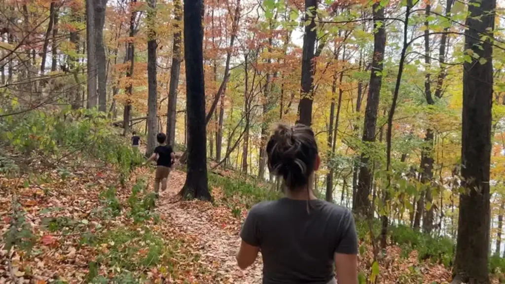
Nashville gets credit for honky-tonks and hot chicken, but the hiking near Nashville TN is honestly one of the city’s best-kept secrets. Within an hour’s drive you can stand under a 136-foot waterfall, watch great blue herons stalk a quiet lake, or knock out a lunchtime loop without ever leaving the city limits.
Quick answer: The best hiking near Nashville TN includes Radnor Lake State Park (5 miles south of downtown, easy-to-moderate loops), Percy Warner Park’s Mossy Ridge Trail (moderate, 7 miles), and waterfall day trips to Burgess Falls and Cummins Falls (60–105 minutes away). Most in-town options are free, dog-friendly on paved sections, and busiest on weekend mornings.
I’ve pulled together the trails locals actually recommend, sorted by how close they are to downtown and how much effort they’ll ask of you — plus the permit and parking details that trip people up.
The Best Hikes Near Nashville at a Glance
| Trail | Distance from Downtown | Length | Difficulty | Best For |
|---|---|---|---|---|
| Shelby Bottoms Greenway | In-city | Up to 5+ miles | Easy | Dogs, strollers, quick trips |
| Radnor Lake – Lake Trail | 20 min | 1.35 mi | Easy | Wildlife, beginners |
| Radnor Lake – Ganier Ridge | 20 min | 1.65 mi | Difficult | Elevation, solitude |
| Mossy Ridge Trail (Warner Parks) | 20–30 min | ~7 mi loop | Moderate | Trail runners, longer hikes |
| Long Hunter State Park – Volunteer Trail | 30 min | Up to 10.7 mi | Easy-Moderate | Lake views, camping |
| Beaman Park | 30–40 min | Up to 14.6 mi total | Moderate | Quiet, rock formations |
| Bells Bend Park | 30–40 min | 2.3 mi loop | Easy | Meadow walks, families |
| Timberland Park | 30–40 min | ~2 mi combined | Easy-Moderate | Wildlife, uncrowded |
| Owl’s Hill Nature Sanctuary | 30–40 min | Varies | Easy | Nature education |
| Harpeth River State Park (The Narrows) | 35–45 min | Short spurs | Easy-Moderate | History, river views |
| Burgess Falls State Park | ~90 min | Under 2 mi round-trip | Easy-Moderate | Waterfalls, day trips |
| Cummins Falls State Park | ~105 min | Varies (permit required) | Strenuous | Swimming, adventure |
Closest & Easiest Hikes (In the City)
If you’re short on time or don’t want to drive far, Nashville’s own greenway system has you covered. Nashville maintains close to 100 miles of formally designated Greenways threading the metro area with hikeable and bikeable routes.
Shelby Bottoms Greenway
In East Nashville, Shelby Bottoms Greenway and Natural Area covers close to 1,000 acres of floodplain habitat along the Cumberland River, with more than five miles of paved, ADA-accessible multiuse paths plus a similar mileage of unpaved, more primitive hiking trails. It’s a genuine wildlife hotspot in the middle of the city — expect waterfowl, deer, and the occasional fox if you’re out early.
Radnor Lake — Lake Trail & Dam Walkway
If you want something scenic but low-effort, Radnor Lake’s flattest trails are both close and easy. The Dam Walkway is the shortest option in the park at roughly 0.2 miles and is ADA-accessible, while the Lake Trail loops the north side of the lake for about 1.35 miles, also fully accessible. Both are great for a quick nature fix before or after work.
Quick takeaway: For a no-planning-required hike, Shelby Bottoms and Radnor’s Lake Trail are the two easiest wins — free, close, and dog-and-stroller-friendly on the paved sections.
Radnor Lake State Park: Nashville’s Most-Loved Trail System
Radnor Lake is the trail every local mentions first, and for good reason. Located just south of downtown Nashville, it’s the largest pocket of wilderness in the U.S. in close proximity to a major city, spanning over 1,200 acres with more than 6 miles of trails. It’s also busy — the park sees nearly one million visitors annually, so weekday mornings are your friend.
Trails, Difficulty & Distances
Radnor packs a lot of variety into a small footprint:
- Ganier Ridge Trail – 1.65 miles, labeled difficult, named for naturalist Albert F. Ganier, co-founder of the Tennessee Ornithological Society
- South Cove Trail – mirrors Ganier Ridge in difficulty, with panoramic lake views partway through
- Historic Valve House Trail – a short, mulched 0.40-mile trail leading to the reconstructed Historic Valve House, worth it for history buffs
- Access Trail – a 0.25-mile moderate connector linking the east parking area to Ganier Ridge and the Lake Trail
For a longer combined outing, the Radnor Full Lake and Ganier Ridge Trail Loop covers about 4.4 miles with 511 feet of elevation gain and takes most hikers 1.5–2 hours.
Rules, Parking & Permits
Radnor is a Class II Natural Area, which changes how you’re allowed to use it. Dogs, joggers, and cyclists are restricted to Otter Creek Road and the dam — off-trail use isn’t permitted anywhere in the park. Parking fills fast on nice weekends since spaces are limited to marked spots only, so arrive before 9 a.m. if you’re set on a Saturday hike. The park is open daily from 6 a.m. until 20 minutes after sunset, and the Walter Criley Visitor Center can supply maps if you want a paper backup.
Quick takeaway: Radnor Lake rewards an early start. Go before 9 a.m. on weekends, stick to the Lake Trail if you’re new, and save Ganier Ridge for when you want a real climb.
Warner Parks: Mossy Ridge Trail and Beyond
Together, Percy Warner and Edwin Warner parks make up more than 2,500 acres only nine miles from downtown, and locally the whole system just gets called “Warner Parks.” The signature route is the Mossy Ridge Trail, a moderately strenuous loop that runs roughly 7 miles and is popular with both trail runners and casual walkers.
The trail winds through open meadows, crosses several springs, and works through dense woodland, with rocky sections in places — proper footwear matters here more than at Radnor. Horses and cyclists aren’t allowed on the hiking trails, which keeps things quieter than you’d expect for a park this close to a major city. Nine separate trails and around 12 miles of total mileage give you plenty of ways to shorten or extend a Warner Parks visit depending on your energy level.
Waterfall Hikes Worth the Drive
If you’ve got half a day, Middle Tennessee’s waterfall hikes are the payoff that in-city trails can’t match.
Burgess Falls State Park
About 90 minutes from downtown, Burgess Falls delivers serious scenery for very little effort. The trail passes a sequence of cascades on the way to the main event — a 136-foot waterfall you reach after passing the 20-foot Falling Water Cascades, the 30-foot Little Falls, and the 80-foot Middle Falls. Round-trip it’s under two miles, which makes it one of the easier “big payoff” hikes on this list, though the final approach ends in a steep stairway down to the falls overlook. Go early — this one gets crowded.
Cummins Falls State Park (Permit Required)
Cummins Falls is roughly 105 minutes east of Nashville near Cookeville, and it’s the one waterfall hike here that actually requires planning ahead. You’ll need a free online gorge access permit from the Tennessee State Parks website before you go, and daily visitor numbers are capped, so don’t wait until you’re in the car. The trail crosses the river twice, so pack water shoes, and the descent into the gorge itself is rugged with steep, slippery sections — this is not a casual stroll. The reward is a swimming hole at the base of a 75-foot waterfall that’s genuinely one of the most photographed spots in the state.
Quick takeaway: Burgess Falls is the easier, faster waterfall fix. Cummins Falls is the bigger adventure — but only if you grab your gorge permit first.
READ MORE: Bachelor Party in Nashville: The Complete Planning Guide
Lake & Reservoir Hikes
Long Hunter State Park — Volunteer Trail
About 30 minutes from downtown, Long Hunter State Park sits on the shore of Percy Priest Lake. The Volunteer Trail (Day Loop) hugs the lake’s southern shore for up to 10.7 miles out-and-back, though you can easily turn back early for a shorter walk. Along the way you’ll pass old stone walls hinting at the area’s history, plus a couple of primitive backcountry campsites if you want to turn a day hike into an overnight trip. It’s an easy trail to shorten for kids or lengthen for a real workout, which makes it one of the more flexible options near Nashville.
Hidden-Gem Parks Locals Love
These four rarely make the “top 10” lists tourists find, but they’re the ones Nashvillians actually return to.
Beaman Park
A 1,700-acre nature reserve about 30–40 minutes from downtown, Beaman Park has three trails covering 14.6 miles total. Expect rugged solitude, interesting rock formations, and small creek cascades — and far fewer people than Radnor Lake on any given weekend.
Bells Bend Park
Bells Bend is a quiet, flat option built around meadow walks — a 2.3-mile loop trail plus several old farm-road paths make it a good pick for families or anyone wanting an easy walk without much elevation. There’s minimal shade, so an overcast day or early-morning start makes it more comfortable in summer.
Timberland Park
Located on the Natchez Trace Parkway near the Loveless Cafe, Timberland Park has trails similar in feel to Warner Parks but with a fraction of the visitors. Combine a couple of loops for roughly two miles, and keep an eye out for deer — this park consistently has some of the highest wildlife sightings in the area.
Owl’s Hill Nature Sanctuary
Owl’s Hill grew out of a former farm property and now functions as a research-oriented nature preserve focused on native ecosystems. It’s a good pick if you want a quieter, more educational hike rather than a workout.
Quick takeaway: If Radnor Lake’s parking lot is full, Beaman Park and Timberland Park are the closest equivalent experiences without the crowds.
Planning Your Hike: Permits, Season, Gear & Kids
Permits: Only Cummins Falls requires an advance permit among the trails on this list; everything else is free, walk-up access.
Best time of year: Spring (wildflowers, active wildlife) and fall (foliage, cooler temperatures) are the sweet spots. Summer hikes are doable early in the day, but shadeless trails like Bells Bend and the final approach to Burgess Falls get hot fast — bring more water than you think you need.
With kids: The Lake Trail and Dam Walkway at Radnor Lake, Bells Bend’s loop, and the first mile of Burgess Falls are all manageable for younger hikers. Save Ganier Ridge Trail and the Cummins Falls gorge descent for when kids are older or hiking with confident adults.
What to pack: Sturdy shoes with grip (several trails here have rocky or slippery sections), water shoes if you’re doing Cummins Falls, sun protection for shadeless stretches, and a paper map or offline app download since cell service drops in some of the more remote parks.
Whichever trail you pick, the pattern holds across nearly all of them: arrive early, especially on weekends, and you’ll trade crowded parking lots for a genuinely peaceful morning outdoors — something Music City doesn’t always get credit for.
Want more like this? Explore more nashville guides on our site.
FAQ Section: Hiking Near Nashville TN
Where can I hike near Nashville for free?
Almost every trail on this list is free, including Radnor Lake, Warner Parks, Beaman Park, Bells Bend Park, and Shelby Bottoms Greenway. The only trail here requiring anything extra is Cummins Falls, which needs a free online gorge access permit.
What is the easiest hike near Nashville?
The Dam Walkway and Lake Trail at Radnor Lake are the flattest, most accessible options, both ADA-friendly. Bells Bend Park’s loop trail is another easy, low-elevation choice good for families.
Do I need a permit to hike near Nashville?
Most in-town and nearby state parks require no permit at all. The exception is Cummins Falls State Park, where a free gorge access permit must be secured online in advance due to daily visitor caps.
Is Radnor Lake good for beginners?
Yes. The Lake Trail and Dam Walkway are flat and easy, making them ideal starting points. Ganier Ridge and South Cove trails are more difficult and better suited to hikers wanting elevation.
How far is Burgess Falls from Nashville?
Burgess Falls State Park is about 84 miles from Nashville, roughly a 90-minute drive, making it a popular half-day or full-day trip.
Are dogs allowed on Nashville hiking trails?
It varies by park. At Radnor Lake, dogs are only allowed on Otter Creek Road and the dam, not the wooded trails. Warner Parks and Shelby Bottoms are generally more dog-friendly on their paved and main trail sections — always check posted rules on arrival.
What’s the best time of year to hike near Nashville?
Spring and fall offer the most comfortable temperatures and best scenery — wildflowers in spring, foliage in fall. Summer hikes are best done early morning due to heat and limited shade on several trails.
Can I combine multiple trails near Nashville into one trip?
Yes — Warner Parks, Beaman Park, and Timberland Park all have multiple interconnecting trails that can be combined for a longer outing, and several trailheads are close enough together (like Radnor Lake and Warner Parks) to visit both in a single day.